MapStand Hub - Energy Transition Data and Visualisations
What is the MapStand Hub?
MapStand Hub is our enterprise solution. It offers a wider range of datasets, including our emerging technology Energy Transition datasets, such as Hydrogen and CCUS (Carbon Capture Utilisation and Storage). Our interactive mapping, data visualisation, and analysis tools are specifically designed to accelerate decision-making by providing your business with powerful insights and visualisations.
Key Features
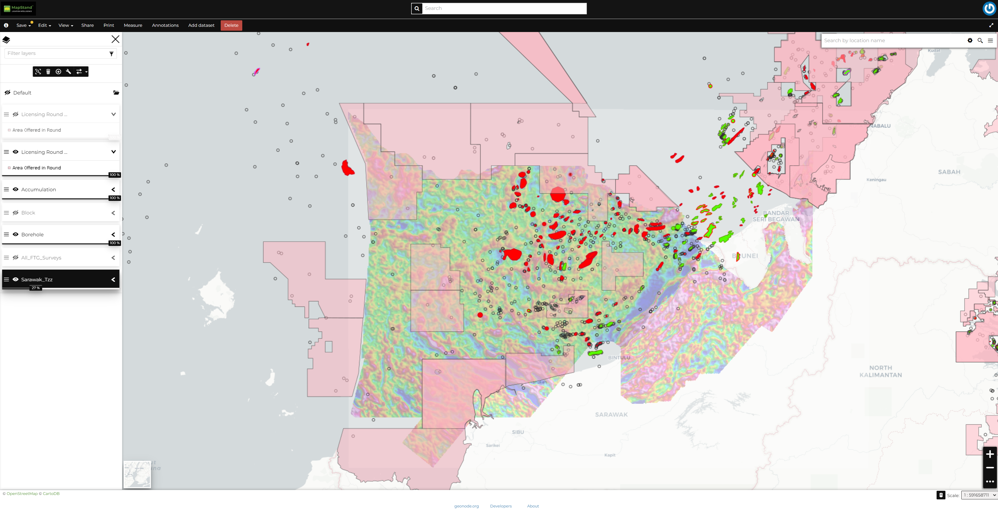
The MapStand Hub allows you greater autonomy by providing the ability to create your own custom web maps, design custom dashboards, access exclusive layers, and more.
-
Energy Transition Data Layers →
Access our Energy Transition data layers.
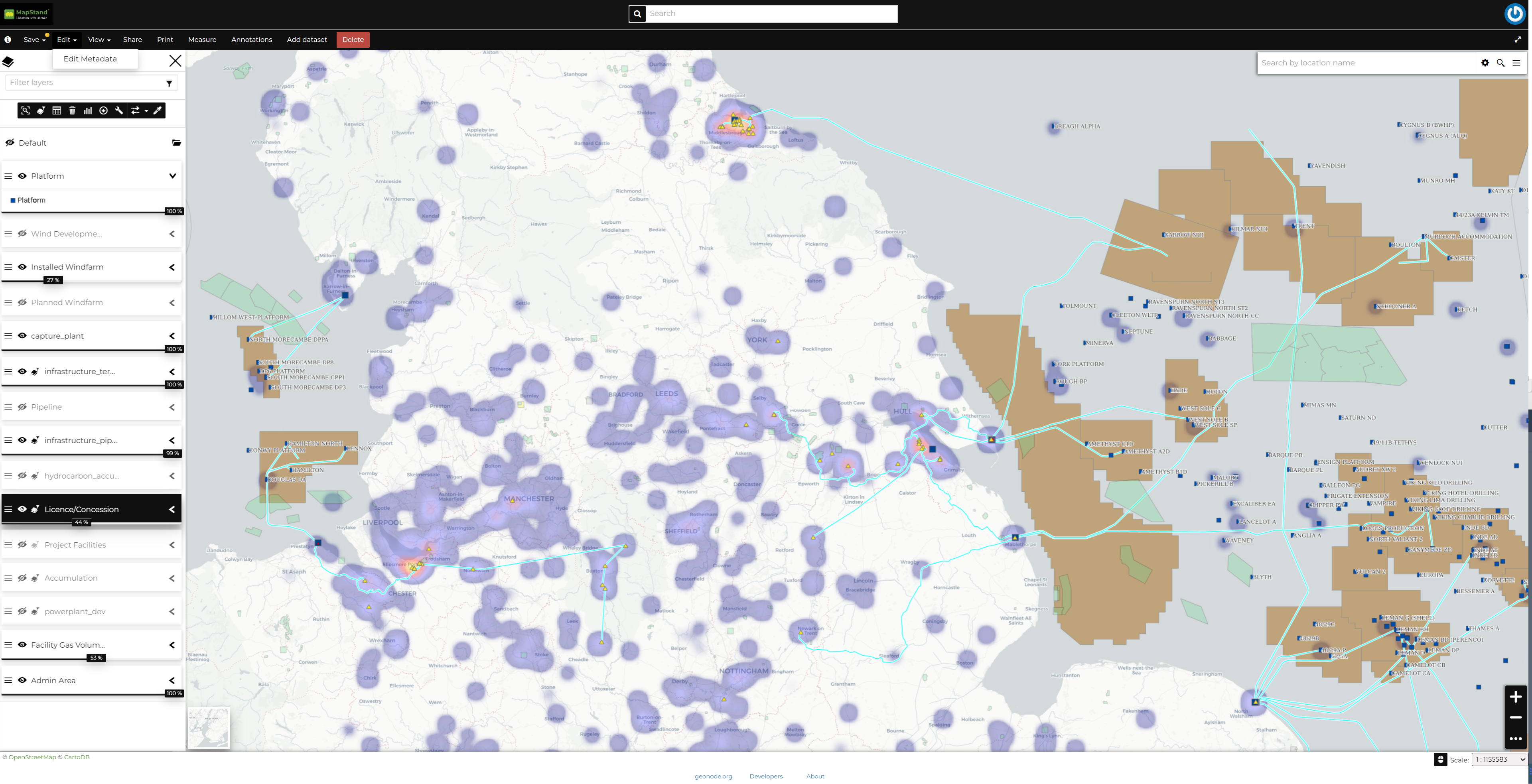
In addition to the layers available via MapStand Platform, HUB customers can access our Energy Transition layers. These datasets support Carbon Capture Utilisation and Storage (CCUS) initiatives and the advancement of the Hydrogen economy.
-
Integrations →
Stream or download and keep MapStand datasets.
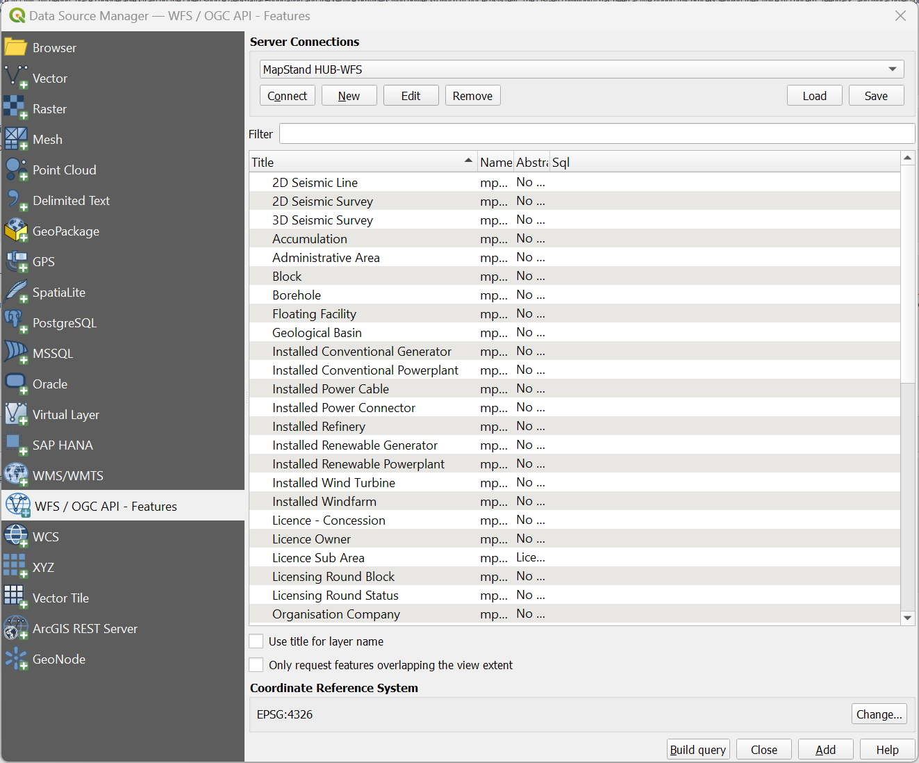
Using our API - OGC web services, MapStand data can be streamed directly into whatever web or GIS business intelligence tool you’re currently using. WMS, WFS, and more - we have the capabilities to integrate with all of them.
Utilise MapStand offline. The data is yours to download. See our terms and conditions for more info.
-
Dashboards →
Data visualisation and analysis.
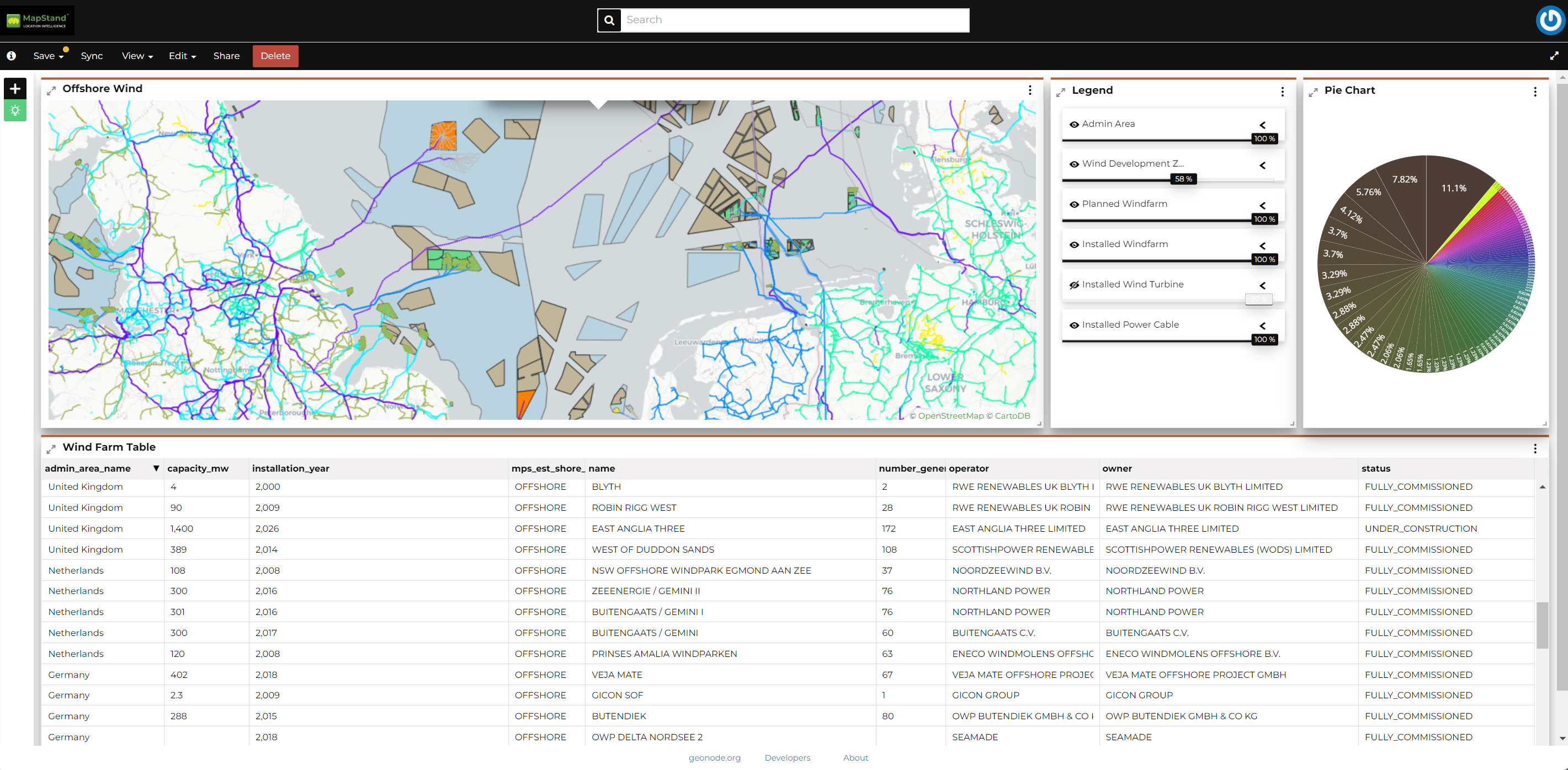
Custom dashboards provide real-time visual representations and offer comprehensive insights into the data. Dashboards make it easy to monitor particular areas, allowing your company to identify industry trends and predict events for making more informed business decisions.
-
Customisation →
Create custom-style maps
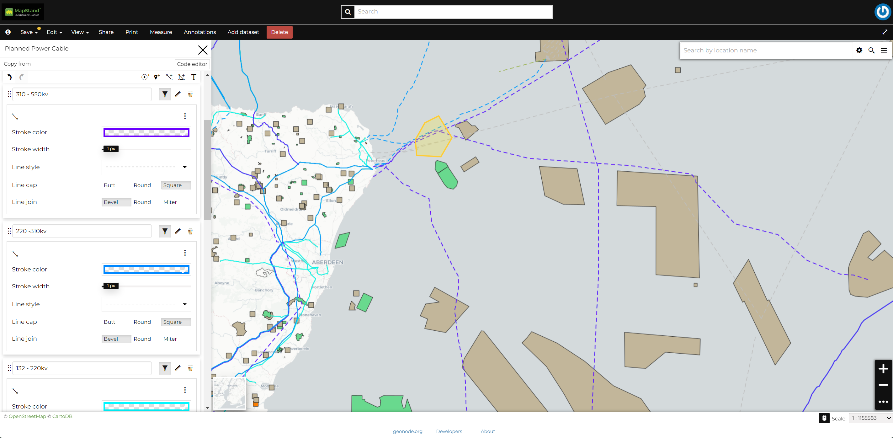
Create custom maps, design your own filters and queries to display just the data that you need. Custom maps can be shared within your organisation.
-
Upload Your Data →
Personalise your maps.
Integrate your own spatial data to assist your mapping projects.


Additional Features
Ease of Use
Our easy-to-use professional mapping tool enables you to explore different assets, test out various layers, and gather large quantities of spatial data via our interactive map. Everything you need to make informed business decisions and maximise your return on investment.
Collaboration
Customise permissions of custom-built maps for remote teams to access and update data with ease. Anytime, anywhere.
Support Bot
We’re on hand when you need us. Get help by searching our repository of support articles, requesting help from our Support Team, or leaving us feedback via the Support Bot.
Support Portal
Our Support Portal provides a self-service option. You can read our FAQs for advice, get answers from our dedicated Support Team, and check the latest info on known issues & new releases.

Oil & Gas data points

Power Infrastructure data points

Energy Transition data points

Happy users

Geotagged news articles
What our subscribers are saying about MapStand
Testimonials
MapStand gives me near-instant access to critical information as I need it – well info, client blocks, current activity…it’s all at my fingertips without waiting for cumbersome mapping packages to update and load.
VP Project Development
Multi-Client Seismic Company
Quick and easy ability to see what is happening, where it’s happening, and who is nearby is an invaluable resource in running A&D.
Partner
Oil and Gas Financial Advisors