-
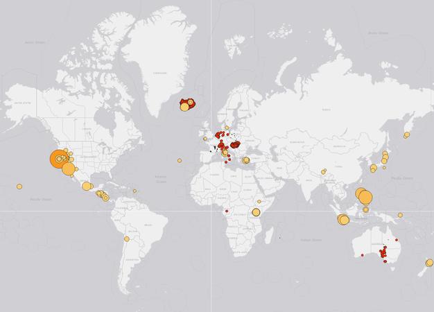
Carbon Capture & Storage →
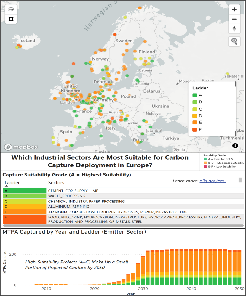
Carbon Capture Projects
MapStand provides critical data to help leading CCS players make informed decisions, from understanding the evolving landscape and tracking projects to uncovering new opportunities. Our data-driven approach enables CCS initiatives to progress with greater speed, certainty, and coordination.
MapStand builds complex datasets from diverse sources by collecting, aggregating, and integrating fragmented CCUS sector information into clear, customisable datasets, offering a unified, flexible view of the CCS landscape to suit our customers views, strategies and ambitions.
Plan, analyse, and optimise CCUS projects with a platform that connects emitters, transport, and storage into one customisable geospatial view.
-
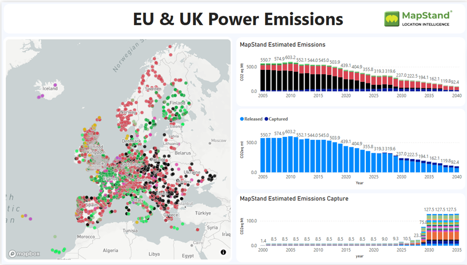
Emitters and Emissions →
Emission Forecasting Model
MapStand’s Emissions Forecasting Model dataset provides insight into emission timelines, essential for long term viability of storage or utilisation and is fully integrated with MapStand’s wider datasets.
MapStand identifies consistent emissions from point source emitting facilities required for long term storage. Our data enhances storage viability, enables analysis of view-points from competing decarbonisation pathways which can risk CO₂ storage viability.
The model supports strategic infrastructure planning, sectoral analyses identification of future decarbonisation clusters, and successful project development.
-
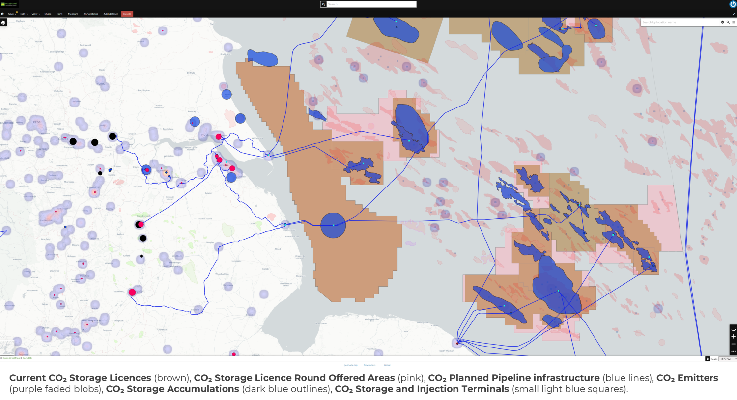
CCS Transportation →
CO₂ Transportation
Transporting CO₂ from emission sources to storage sites demands significant infrastructure, investment, and robust feasibility analysis. MapStand’s comprehensive energy infrastructure database enables rapid assessment of CO₂ transport routes, identification of viable emission clusters, and evaluation of storage site availability, including depleted fields and aquifers suitable for CO₂ or hydrogen storage.
We support our customers by transforming fragmented data into a single, integrated view of the energy infrastructure ecosystem. MapStand clean, combine and normalise data from various sources that delivers timely and accurate data to our customers.
-
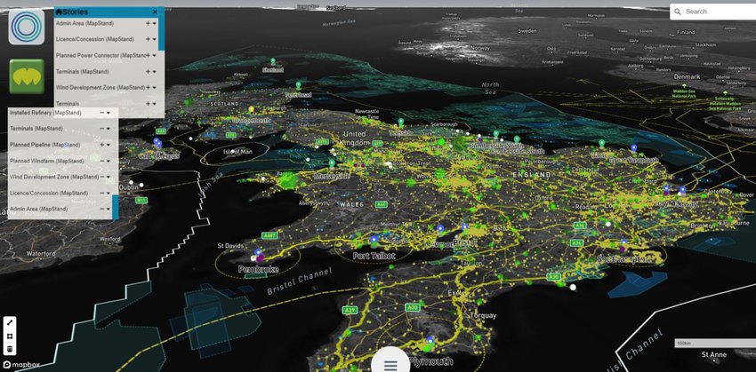
Geothermal Energy →
Geothermal Energy
MapStand global geodatabase now includes Geothermal energy data such as borehole locations as well as exploration, production, and research geothermal licences. The Geothermal infrastructure layer also includes geothermal borehole locations, as well as other Geothermal energy data.
Data Sources